|
|
| Date: |
|
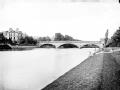
| Description: | This plan covers parts of Warwickshire and Worcestershire, with the Severn Valley depicted in the middle. The River Avon meanders north-eastwards from Tewkesbury (where it meets the River Severn) to Stratford on Avon, where, after 17 locks, it joins the Stratford-on-Avon Canal. Below the Avon, near the bottom of the sheet, the Cotswolds form a dramatic limestone escarpment above the Severn Valley and Evesham Vale. Jurassic limestone, used as a building material throughout the area, gives the Cotswolds its distinctive look. | | License: | http://www.bl.uk/services/copy/permission.html | | Rights holder: | British Library | | Subjects: | Woodland
Agriculture
Plans
County maps
Cartography And Topography
Landscapes
Maps
Trade And Economics | | Source: | Collect Britain | | Creator: | [Dawson, Robert] | | Identifier: | http://www.collectbritain.co.uk/personal... | | Language: | en-GB | | Go to resource |
|
|