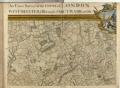
| Description: | Bound sheet. Hand col. engr. Scale: ca. 1:12 370 (bar). Cartographic Note: The map has bar scales in miles, furlongs and perches on sheet 1; in feet, chains and yards on sheet 9, and in woerst de Moscovie, French leagues and toises, and Swedish Danish and Swiss leagues on sheet 16. Additional Places: Islington, Westminster, City, Southwark.
Sheet x3,y3 of a sixteen sheet map.
caption: John Roque's 1746 London Atlas, Islington & Thames
caption: PBC5317/6 An exact survey of the cities of London and Westminster, the Borough of Southwark... |