|
|
| Date: |
|
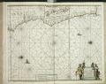
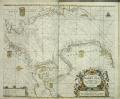
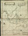
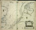
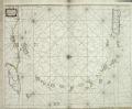
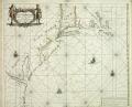
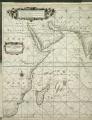
| Description: | Bound sheet. Hand col engr. Cartographic Note: North at 270 degrees. Border graduated for latitude. Bar scale in Dutch miles only. Additional Places: Pacific America. Contents Note: California is shown as an island. The chart contains three insets, separated by tendril decoration, and each with its own latitude scale and compass rose: New Zealand; Pacific islands including the Ladrones, and Japan. Bound in 'De Zee-Atlas ofte Water-wareld', published by Doncker in 1661.
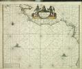
caption: PBD8015, Doncker Zee-atlas 1661, Chili, Peru | | Publisher: | "http://collections.rmg.co.uk/" | | Rights holder: | "Royal Museums Greenwich" | | Source: | Royal Museums Greenwich | | Identifier: | http://collections.rmg.co.uk/collections... | | Go to resource |
|
|