|
|
| Date: |
|
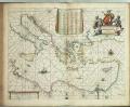
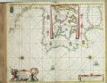
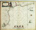
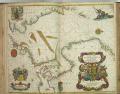
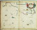
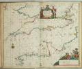
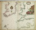
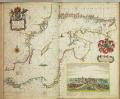
| Description: | Bound sheet. Hand col engr. Scale: [ca. 1:5 000 000 (bar)]. Cartographic Note: Borders graduated for latitude. Bar scales in English and French leagues, Spanish leagues and Dutch miles. Contents Note: Contains an inset list of names of islands, capes, havens etc. A chart from 'Atlas Maritimus', or the Sea Atlas; being a book of maritime charts.
caption: PBE6862, Seller Atlas Maritimus, w. part of Medit. | | Publisher: | "http://collections.rmg.co.uk/" | | Rights holder: | "Royal Museums Greenwich" | | Source: | Royal Museums Greenwich | | Identifier: | http://collections.rmg.co.uk/collections... | | Go to resource |
|
|