- Back
-
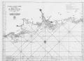
Title: 2mee Carte Particliere des Costes de Normandie contenant les costes du Cotentin depuis la Point de la Penee jusqu' a Granville ou sont conprises les Isles de Jersey Grenezey Cerz & Aurigny avec les Isles de Brehat [Go to resource]

Description: Scale: circa 1:200,000. Chart of the north coast of France, Cherbourg Peninsula and the Channel Islands. Prime meridian on London, Lizard, Tenerife, Isle de Fer and Paris. Coordinates given. Has been repaired and backed. Publisher: "http://collections.rmg.co.uk/" Source: Royal Museums Greenwich Identifier: http://collections.rmg.co.uk/collections... Go to resource More Like this...
[Edit] - Back


- Home |
- About |
- Add |
- Use |
- Contact us